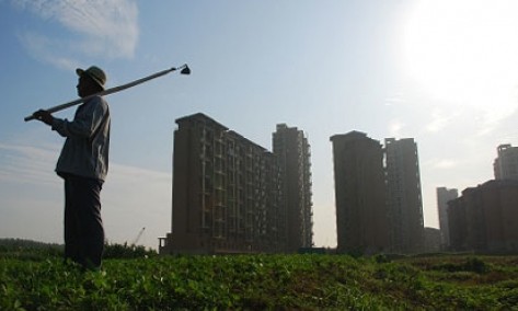
WB Provides New Data to Help Ensure Urban Growth Benefits the Poor
chinagate.cn, January 26, 2015 Adjust font size:

Almost 200 million people moved to urban areas in East Asia from 2000-2010 – a figure that would be the world’s sixth-largest population for any single country, according to new data released Monday by the World Bank.
For the first time, the data compares urban areas and their populations in a consistent manner across East Asia, providing governments and local leaders with a better understanding of the shape and scale of the growth so they can get urbanization right – creating opportunities for all.
“Rapid urbanization is a significant challenge for East Asia, but we cannot manage what we cannot measure,” said Axel van Trotsenburg, the World Bank East Asia and Pacific Regional Vice President. “We’re releasing this data so urban leaders can get a better picture and take action to ensure that urban growth benefits the increasing number of people moving to cities, especially the poor.”
Analyzed in a new report titled “East Asia’s Changing Urban Landscape: Measuring a Decade of Spatial Growth,” the data indicates that overall, urban areas in East Asia expanded at an average of 2.4 percent per year during the decade studied, with urban land reaching 134,800 square kilometers in 2010.
Urban populations grew even faster at an annual average rate of 3.0 percent, increasing to 778 million in 2010 – the largest of any region in the world. Other sources indicate that it took more than 50 years for the same number to become urbanized in Europe.
The report finds a direct link between urbanization and income growth, showing how economic output per capita increased throughout the region as the percentage of people living in urban areas went up.
The report says that there are 869 urban areas with more than 100,000 people in the East Asia region. They include eight megacities of more than 10 million people: the Pearl River Delta, Shanghai and Beijing in China; Tokyo and Osaka in Japan; and Jakarta, Seoul and Manila. China’s Pearl River Delta has overtaken Tokyo to become the largest urban area in the world in both size and population.
At the same time, there was significant growth in smaller urban areas. In fact, the 572 smallest urban areas – with populations of 100,000 to 500,000 – as well as the 106 medium-sized urban areas with populations of 1 million to 5 million, have more total land area than the eight megacities.
A notable feature of this expansion is that urban areas are also getting denser on average, which if well managed, can be good for the environment and can lead to more efficient provision of services to people. However, this growth poses a significant challenge due to metropolitan fragmentation, with almost 350 urban areas spilling over local administrative boundaries. In some cases, multiple cities are merging into a single entity while they continue to be administered separately.
As urbanization transforms the face of East Asia, governments and local leaders trying to understand and respond have been hampered by a lack of internationally comparable data because countries use differing definitions of urban areas and populations.
The new data set was created to address this challenge by using satellite imagery and techniques for modeling population distribution, mapping all human settlements to achieve a common understanding of urbanization trends. This approach can systematically establish where urbanization is occurring, how fast it is happening, and how population growth relates to increases in urban land area.
“Once cities are built, their urban form and land-use patterns are locked in for generations,” said Marisela Montoliu Munoz, Director of the World Bank Group Social, Urban, Rural and Resilience Global Practice. “Improving the quality of data to understand trends in urban expansion is important, so that policy makers can make better-informed decisions to support sustainable communities in a rapidly changing environment, with access to services, jobs and housing.”
Despite such significant and rapid growth, the data reveals that less than one percent of the total area in East Asia is urbanized, and only 36 percent of the total population is urban – suggesting that the region’s urban expansion has only just begun. While urbanization in the region is largely driven by market forces, policy makers at the national and municipal levels have an important role to play in ensuring that it is sustainable and inclusive:
1. Prepare for future spatial expansion by facilitating access to land so expansion can occur efficiently, using mechanisms such as guided land development, land pooling and readjustment, land sharing and transfer of development rights.
2. Ensure economically efficient urbanization by addressing the entire system of cities through national urbanization strategies, supporting public investments in a range of large, small and medium-sized cities to foster diverse economic activity.
3. Make urbanization inclusive by planning spatial growth to help reduce inequality in access to economic opportunities and address the vulnerabilities of recent migrants.
4. Foster sustainable urbanization by ensuring high-density urban areas are well located, planned and coordinated to produce a walkable, livable environment.
5. Overcome metropolitan fragmentation by coordinating urban services across municipal boundaries, using regional government authorities and other mechanisms.
“Getting urban form, density, and administrative coordination right will be essential to help end extreme poverty and boost shared prosperity,” said Abhas Jha, the Practice Manager for the World Bank Group Social, Urban, Rural and Resilience Global Practice.