Mt. Qomolangma remeasuring surveyors arrive at base camp at a height of 6,500 meters
Xinhua,May 08, 2020 Adjust font size:
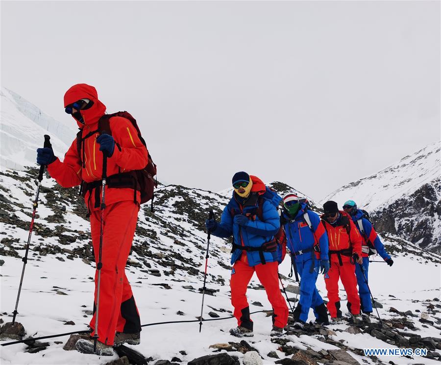
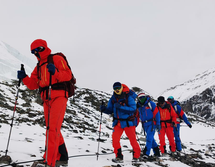
Chinese surveyors hike toward a higher spot after setting out from a base camp at an altitude of 5,200 meters in southwest China's Tibet Autonomous Region on May 7, 2020. The Chinese measurement team of over 30 surveyors Thursday arrived at a base camp at an altitude of 6,500 meters, as they endeavor to accomplish a mission to remeasure the height of the world's highest mountain. (Photo by Lhagba/Xinhua)
MOUNT QOMOLANGMA BASE CAMP, May 7 (Xinhua) -- A team of more than 30 Chinese surveyors arrived on Thursday at their base camp at an altitude of 6,500 meters, as they aim to remeasure the height of the world's highest mountain.
The team safely arrived at the advance camp at around 5 p.m. on Wednesday, after trekking from their base camp, which has an altitude of 5,200 meters, located in Tingri County of Tibet Autonomous Region in southwest China.
The team will rest up and continue to repair height measuring equipment at the base camp for at least a day before moving on.
They arrived at a transition camp at a height of 5,800 meters at around 6 p.m. on Wednesday and spent the night there. The surveyors began climbing at around 11 a.m., passed by the East Rongbuk glacier, and arrived at the advance camp after a six-hour walk.
The advance camp sits on a slope next to the end of the glacier and is the last camp before the snow line and the ice and snow road. After roughly an hour's walk up from the camp, the surveyors will arrive at the shoe-changing point, where climbers need to wear crampons to continue climbing on the icy road.
Known as the "devil camp," many of the professional mountain guides, who have reached the peak of Mount Qomolangma countless times, also suffer from altitude sickness here due to its geographical location. It's an area surrounded by mountains and poor air circulation.
After the advance camp, there are three more camps at altitudes of 7,028 meters, 7,790 meters and 8,300 meters along the traditional climbing route on the northern slope of Mount Qomolangma.
The team, consisting of professional climbers and surveyors from the Ministry of Natural Resources, will seize the current weather window and attempt for the summit at the optimal time. The surveyors will conduct surveys at the summit using devices including the Global Navigation Satellite System and gravimeter.
Prior to the ongoing summit survey, surveyors have completed leveling, GNSS, gravity and astronomical surveys in the surrounding areas of the mountain.
Located at the China-Nepal border, Mount Qomolangma is the world's highest peak, with its north part located in Xigaze, Tibet.
Since the founding of the People's Republic of China in 1949, Chinese surveyors have conducted six rounds of scaled measurement and scientific research on Mount Qomolangma and released the height of the peak twice in 1975 and 2005, which was 8,848.13 meters and 8,844.43 meters respectively. Enditem